
Zugspitze
Germany · Local area · 20 km · pistes
Official source · Reviewed 02/10/2026
Zugspitze snow forecast. Weather in Zugspitze today and tomorrow. Explore the ski trail map · lift ticket prices. Forecast snowfall is new snow expected, not measured snow depth or an official snow report. Check the season and conditions shown with ticket prices.
Glacier-plateau skiing below Germany's highest summit, above Garmisch-Partenkirchen.
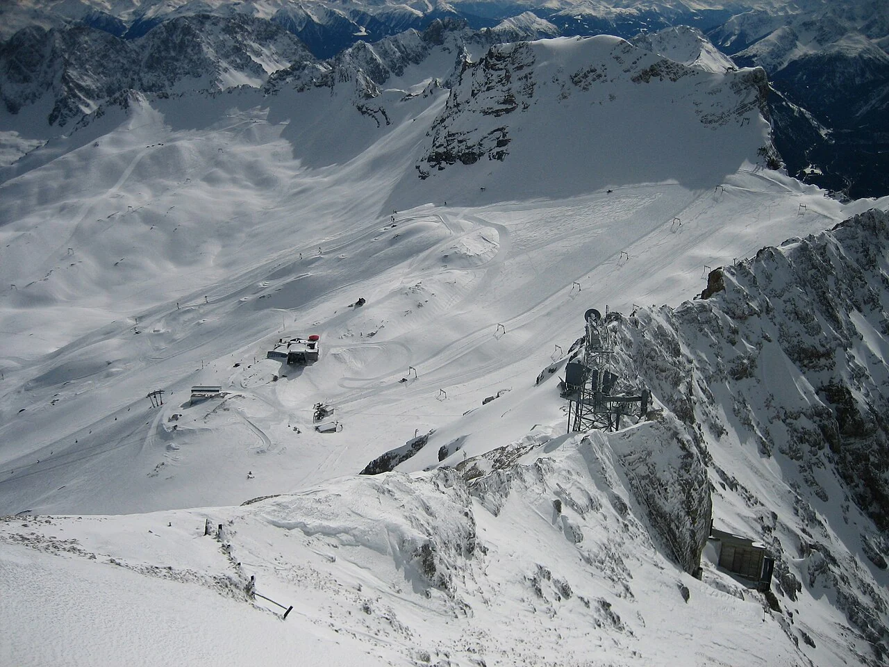
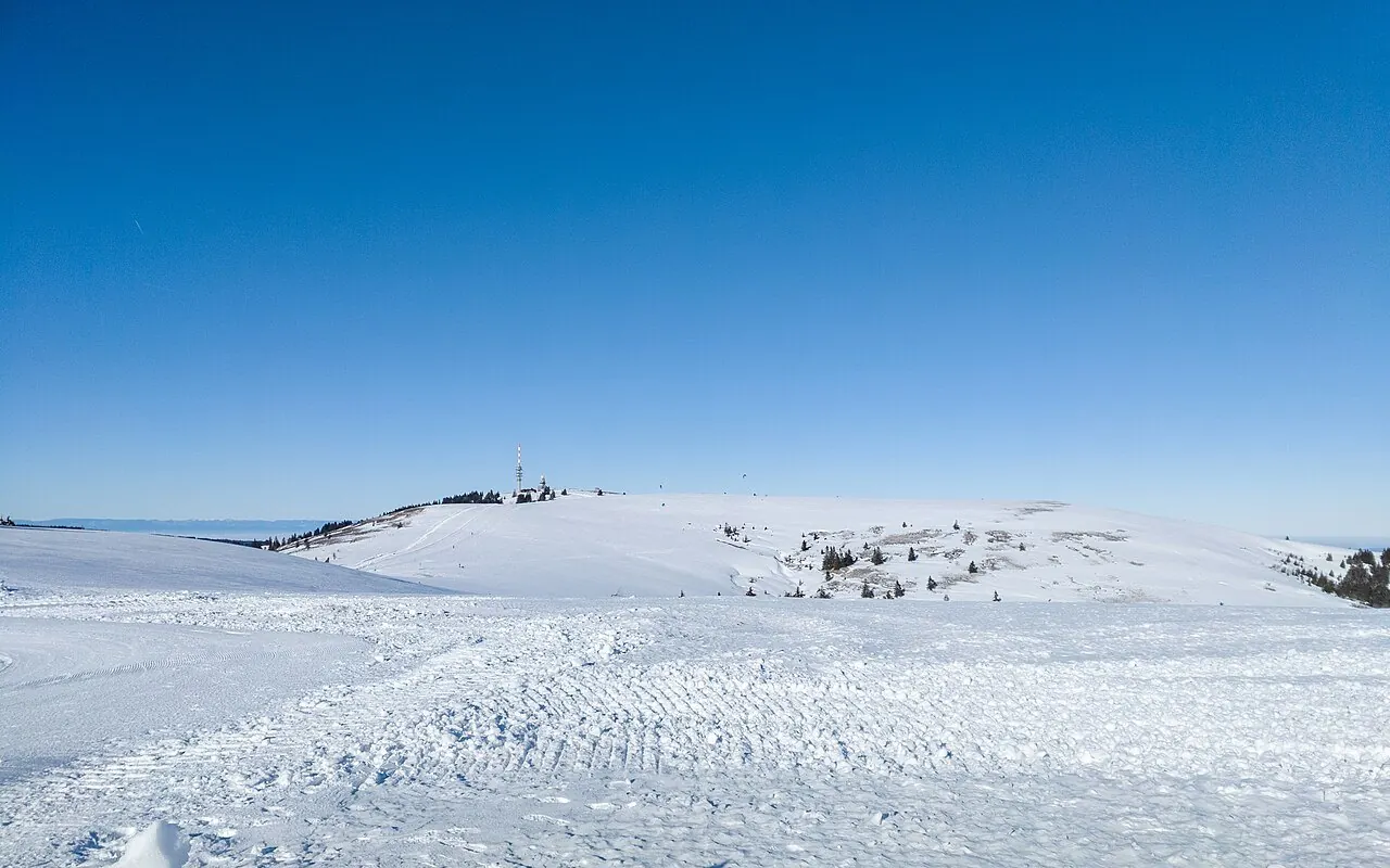
The snow-covered Zugspitzplatt ski area seen from the summit platform. Crux · CC BY-SA 2.5 · Image source and modifications
Archive photograph; not current snow conditions.
Zugspitze and Garmisch-Classic are separate ski areas. Check the correct ticket and mountain access for the area you want.
January–March is an indicative winter travel window for this destination. It is not an opening calendar or a snow guarantee. Check the resort’s own updates before committing to dates.
Bavarian mountain towns make skiing easy to combine with a broader Alpine trip. Around Garmisch, the glacier plateau and lower slopes are distinct areas.
Before setting off, compare the wind and the temperatures at the forecast point with the elevations you plan to ski. New snowfall in the forecast and snow depth on a piste describe different things. The operator’s latest lift and piste report is the place to check what is open.
The forecast point is at about 2,670 m (Copernicus DEM / Open-Meteo terrain estimate).
For a nearby comparison, Innsbruck is about 36 km away in a straight line. Check both forecasts if your plans include these places. The distance is measured in a straight line, not along the road.
Around the June solstice, there are approximately 16h 00m of daylight, compared with 8h 30m at the December solstice. These are astronomical estimates, not sunshine forecasts; cloud and the local horizon affect the light you see.
Compare seasons in the weather history. Check the selected period, source and data coverage: station observations and gridded historical estimates describe different records.
Distances are approximate and measured in a straight line. Nearby places may not have a direct road, piste or lift connection.
Sources: Destination information · Daylight calculation
A nearby listed settlement is Grainau, approximately 8 km from the forecast point in a straight line. GeoNames lists a population of 3,674 for this settlement.
Population refers to the settlement, not the ski area or its visitors, and may not reflect the latest census. Source: GeoNames · CC BY 4.0
The forecast point is at 47.4160, 10.9790, using the Europe/Berlin time zone. The nearby ski-area links below let you compare conditions across the region.
Distances are approximate straight-line measurements from the catalogue location. Check the road route and return transport before choosing a place to stay; proximity alone does not establish a convenient transfer.
Open the location map here, plan your route and view available webcams in the area.
Coordinates: 47.416,10.979
The location is a guide reference point, not a verified car park or lift entrance. Check the final approach road with the official source.
Get a first look at Zugspitze and its mountain surroundings. Open the available camera views, then use the location map to plan your visit.
Webcams published for Zugspitze.
Webcams: ZugspitzeThe main camera loads as you scroll near it. Close it to stop the view; open additional cameras below. Check the provider’s timestamp: images may be old or offline. A nearby ski webcam does not necessarily show the road or pass.
Separate piste-top, base and village elevations have not yet been documented.
The nearest settlement is not automatically treated as the ski village or base.
Vertical difference is a height difference, not piste length or confirmation that a route is open.
Official source · Source reviewed 2026-10-09
| When it applies | Adult · 1 day | Child · 1 day |
|---|---|---|
| Online | 70.5 EUR | 35.5 EUR |
| Ticket office | 78 EUR | 39 EUR |
Children 6–15, youth 16–18. Prices from 27 Nov 2026. Lower online price, higher ticket-office price. Six-day Top Snow Card covers a wider area in Germany and Austria. Season pass covers Garmisch-Classic + Zugspitze.
Size and access
For Zugspitze the ski-area comparison is: local area: 20 km (Zugspitze).
For a comparison in the same category, Feldberg is listed with 24 km. Published measurement methods and area boundaries may differ; the number does not indicate how many pistes are open today.
Germany · Local area · 20 km · pistes
Official source · Reviewed 02/10/2026
Local, linked and regional totals overlap and must not be added. Run counts and terrain in acres are different measures from piste length in km.
Mapped ski pistes and lifts around Zugspitze. Explore the mapped routes and compare them with the operator’s official map.
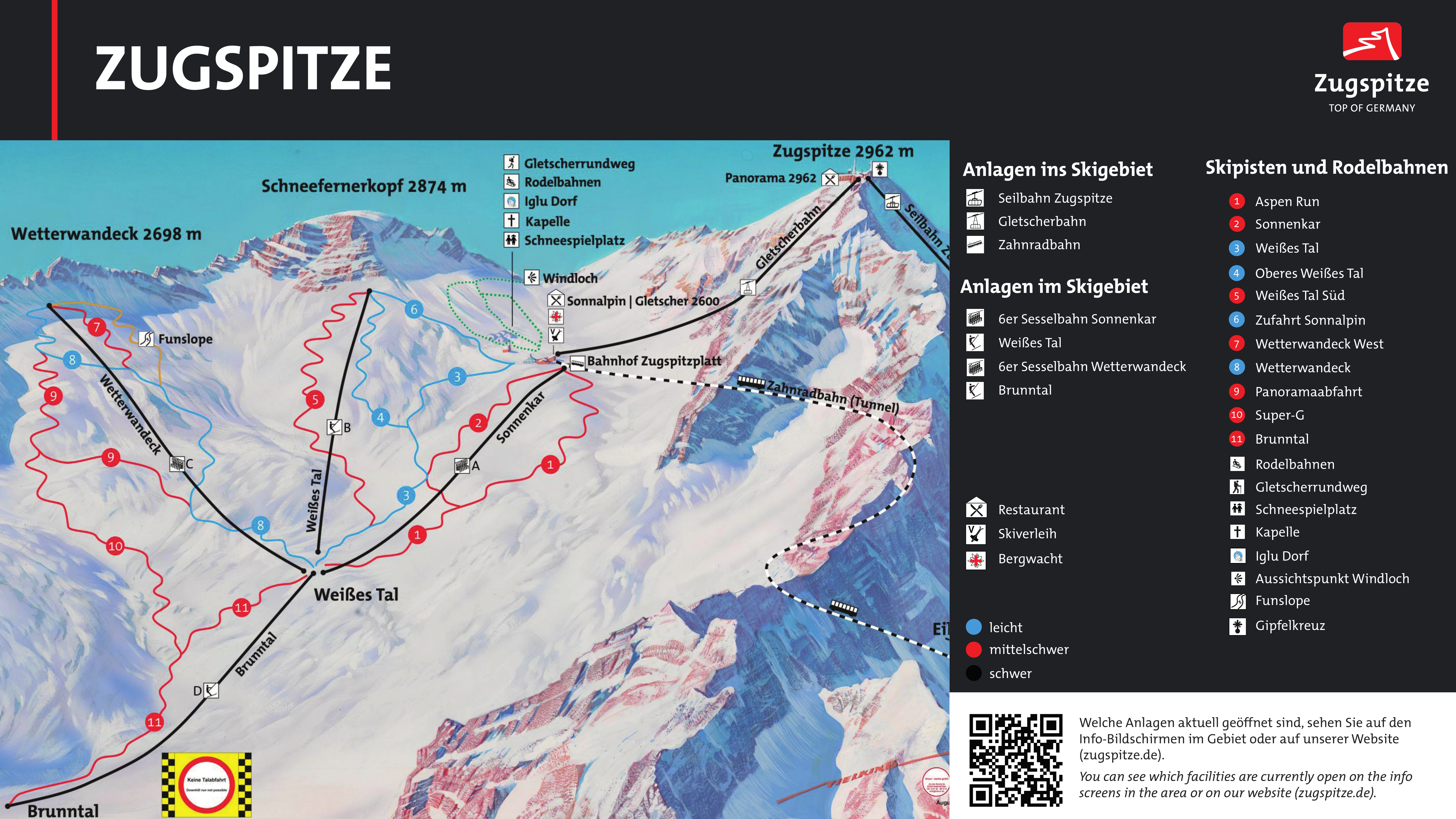
Enlarge map · 6000 pxOriginal imageOfficial map source
© OpenStreetMap contributors · OpenSnowMap.org · Rendering: XIONIA
Interactive map: OpenSnowMap. Images above: official resort piste maps.
GFS · ECMWF IFS · AIGFS · AIFS · GEM. Forecast at an indicative destination point; not a summit forecast or live snow depth.
Loading local weather signals…
See also location and elevation selection · Zugspitze, the forecast table · Zugspitze, the charts · Zugspitze, the model comparison · Zugspitze and weather history · Zugspitze.
Start with the 14-day weather forecast. Open the detailed tables to compare models, then explore hourly temperature, precipitation, wind and 850 hPa in the meteogram. Ensembles show the spread of possible outcomes; satellite images show observed clouds.
Available model families combine per variable. “Today” with hours in parentheses covers the stated window; subsequent days require full local coverage. Days 8–14 are less certain; missing data remain blank. Snowfall cm are fresh snow, not snow depth. Sea-level pressure. Terrain temperature downscaling by Open-Meteo; no Agios Stefanos calibration. A point forecast cannot describe every piste or assess avalanche danger. Open-Meteo
Forecasts at the resort and surrounding locations. Zoom or move the map and select a weather label.
Select a point for its forecast. Peaks and road passes are separate categories; a map position does not indicate a ski route or an open road.
Straight-line distances from the resort forecast point.
The map loads as it approaches the screen.
850 hPa temperature, 2 m temperature and precipitation ensembles for Weather in Zugspitze. Choose Open-Meteo or Direct. Auto tries Open-Meteo first, then Direct when unavailable. Direct retains the native time steps of each model; the displayed source and interval apply. Individual member availability varies by model and variable.
Weather models and interactive ensembles · Model comparison · Weather in Zugspitze
Visible, infrared and available RGB cloud imagery for Weather in Zugspitze. Satellite coverage and observation times vary by region.
Satellite images and rain radarThis summary uses the destination’s fixed coordinates and the historical service’s terrain elevation. It does not change with the forecast’s manual elevation setting. Mountain terrain, wind redistribution and snowmaking are not fully represented. Snowfall days do not indicate opening days or piste snow depth.
Explore rain and snowfall frequency, monthly average daily lows and highs, and daily temperature extremes over the selected period.
The historical summary loads automatically…
| Month | Mean low °C | Mean high °C | Precipitation mm/month | Rain days/month | Snowfall days/month |
|---|
Choose 10, 20 or 30 years of temperature and precipitation history. The 100-year option searches for a nearby NOAA station with a sufficiently long record; the table shows the actual coverage. NASA POWER / MERRA-2 and ERA5 provide gridded historical estimates, while NOAA GHCNd contains station observations. These sources are shown separately, not combined into one time series.
A precipitation day has at least 1 mm of total precipitation. Where a source reports rain separately, the rain-day figure covers rain alone. A snowfall day has at least 0.1 cm of fresh snow where that variable is available; it does not establish snow cover on the ground. NASA POWER does not provide snowfall here. Blank values mean missing data, not zero. Averages and extremes use only the complete months or years stated in the table. These historical figures do not automatically calibrate the forecast.
 The shortlist
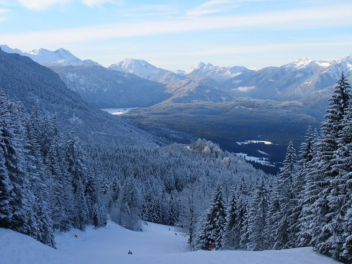
The lower mountain ski area above Garmisch-Partenkirchen, separate from Zugspitze.
 The shortlist
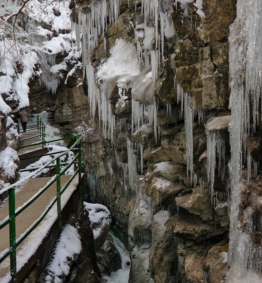
Several mountain areas across Germany’s border with Austria.
 The shortlist
Black Forest skiing around the Feldberg mountain.
Verified ski connections come first. Other destinations are ordered by straight-line distance, which does not imply a piste or road connection.
Global Forecast System: a numerical model that simulates atmospheric physics.
Artificial Intelligence Global Forecast System: a machine-learning model initialized from NOAA atmospheric analyses.
Integrated Forecasting System: the intergovernmental European centre’s numerical model. IFS 9 km and IFS 0.25° are products of the same model family on different data grids.
Artificial Intelligence Forecasting System: this page uses AIFS Single, which produces one forecast scenario.
Global Environmental Multiscale: the atmospheric model within Canada’s GDPS. The current system combines numerical prediction with large-scale guidance from the GEML AI model.
Regional numerical weather model for Europe, with a finer grid than the global ICON version.
Global numerical weather model from the German Weather Service. Resolution varies by data product.
Global numerical forecast from the Met Office. MOGREPS-G is the provider’s separate ensemble system.
European output from Météo-France’s ARPEGE numerical model. Coverage and variables depend on the available product.
Global Spectral Model: the Japan Meteorological Agency’s global numerical weather model.
Artificial intelligence ensemble with 31 members. It complements the single AIGFS forecast with alternative scenarios and their spread.
The blend uses the values available for each day and variable. Coverage falls as individual models reach their forecast limits. The two IFS products are not independent models. Model spread shows disagreement, not the probability of a weather event.
Wind: maximum daily speed at 10 m and prevailing direction of origin. Direction uses a speed-weighted circular calculation; missing or strongly opposing directions display a dash. 🥶: low below 0°C. 🥵: high above 30°C. 💨 in Conditions: wind at least 40 km/h or gusts at least 60 km/h.
Forecast data: Open-Meteo · NOAA / ECMWF / ECCC.
The choice applies to widgets, maps and forecasts. Actual station readings stay unchanged. Automatic tries Open-Meteo first, then available direct sources if a supported request fails.
Data service providing forecasts from NOAA, ECMWF, ECCC, DWD, the Met Office, Météo-France and JMA. Available models, variables and grids depend on the location and product.
XIONIA collects data directly from the model providers. Forecasts and maps are served after the source cycle has been published and collected. The selected product shows its model, resolution, available variables and run.
Each available family contributes once per variable. Direct forecasts select the freshest available GFS grid and use equal family weights as the baseline. Local weights apply only where enabled after validation. The comparison shows actual percentages and model cycles.
Additional model forecasts are also shown for comparison and backtesting. Their presence does not automatically add weight to the combined forecast; check the displayed weights.
A dash means unavailable data. Wind and gust may use different models. AIGFS temperature is excluded when it cannot be compared on the same elevation basis. Six-hour precipitation is water equivalent, not snow depth.
A “Today” label with hours in parentheses covers only the stated time window; subsequent days require full local coverage. Days 8–14 are a less certain outlook. Agreement between models is not a probability from a true ensemble.
Ensemble systems provide multiple forecast scenarios; the available systems appear in the chart selector and image catalogue. AIGFS is the single forecast; AIGEFS is the separate ensemble. Available variables and forecast horizons differ by system.
Open-Meteo · NOAA · ECMWF Open Data · ECCC Open Data · DWD / ICON · Met Office / UKMO · Météo-France / ARPEGE · JMA
Pass Atlas · Mountain road passes
The forecast point for Zugspitze is at 2,670 m (Bavaria · 47.4160°, 10.9790°).
Use the daily forecast to compare fresh snow, temperature and wind. The mountain view shows the selected day and model; XIONIA’s combined forecast is selected initially. Fresh snowfall and snow already on the ground are separate measurements. Snowfall elevation is a model value or a labelled approximate estimate when available. Days 8–14 show a less certain trend.
The forecast refers to this point; conditions on the summit and at the ski base can differ. Check the resort operator for lift and piste status.