Temperature
— °C
Daily high / low
- High
- — °C · —
- Low
- — °C · —
Loading Agios Stefanos observations…
Daily high / low
Direction —
Today’s total
—
Satellite images show clouds, radar estimates precipitation, and lightning detectors record electrical discharges. The Windy map below shows an ECMWF rain forecast. Check each provider’s timestamp; images can be delayed.
Follow cloud movement over Greece and Europe using visible, infrared and available RGB satellite imagery. Infrared is useful at night; check the observation time before comparing cloud cover with the rain radar. For the Americas and Atlantic, select NOAA GOES-East or GOES-West. Satellite channels, animation and coverage guide.
Go directly to lightning detection for Greece and Europe, the rain radar, satellite images or the Snowly snowfall forecast map.
Follow recent rain-radar images, the time of each composite frame and available coverage. Playback starts while the map is visible; use the controls below it to pause or choose a time.
Explore available precipitation in Windy rain radar. Change region, time and layer within the map. Coverage depends on the available radar networks.
Radar, satellite and lightning on the XIONIA interactive map · Windy
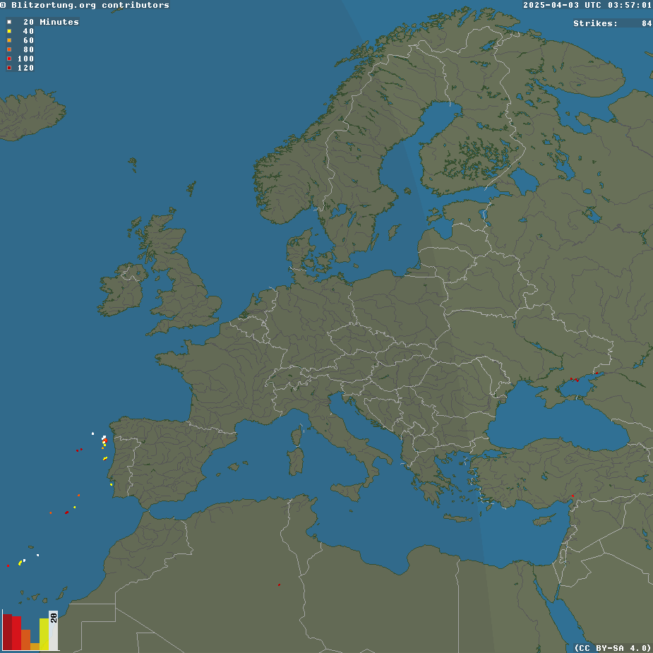
Explore recent lightning detections from the Blitzortung network in Greece, Europe and other covered regions. Pan, zoom or use fullscreen. The provider’s legend explains how colours distinguish the age of detections.
Lightning detections and rain radar are different observations: compare them to follow a storm. Network coverage and accuracy vary by region; no detections does not mean no danger. This map is not a warning or protection service.
Open map at Blitzortung · Greece and Europe rain radar · Weather now and live lightning
Detections and map: Blitzortung.org contributors · Powered by www.xionia.com
Explore predicted snowfall over Europe and Greece in 2D or 3D. Snowly processes ICON-EU, IFS, GFS and GEM forecasts and offers 3-hour and accumulated snowfall layers.
Values show liquid-water equivalent in mm, not centimetres of fresh snow or snow lying on the ground. Check the selected model, initialization time and forecast validity inside the map.
Source and application: Snowly.eu · open the full map.
The choice applies to widgets, maps and forecasts. Actual station readings stay unchanged. Automatic tries Open-Meteo first, then available direct sources if a supported request fails.
Data service providing forecasts from NOAA, ECMWF, ECCC, DWD, the Met Office, Météo-France and JMA. Available models, variables and grids depend on the location and product.
XIONIA collects data directly from the model providers. Forecasts and maps are served after the source cycle has been published and collected. The selected product shows its model, resolution, available variables and run.
Each available family contributes once per variable. Direct forecasts select the freshest available GFS grid and use equal family weights as the baseline. Local weights apply only where enabled after validation. The comparison shows actual percentages and model cycles.
Additional model forecasts are also shown for comparison and backtesting. Their presence does not automatically add weight to the combined forecast; check the displayed weights.
A dash means unavailable data. Wind and gust may use different models. AIGFS temperature is excluded when it cannot be compared on the same elevation basis. Six-hour precipitation is water equivalent, not snow depth.
A “Rest of day” label covers only the stated time window; subsequent days require full local coverage. Days 8–14 are a less certain outlook. Agreement between models is not a probability from a true ensemble.
Ensemble systems provide multiple forecast scenarios; the available systems appear in the chart selector and image catalogue. AIGFS is the single forecast; AIGEFS is the separate ensemble. Available variables and forecast horizons differ by system.
Open-Meteo · NOAA · ECMWF Open Data · ECCC Open Data · DWD / ICON · Met Office / UKMO · Météo-France / ARPEGE · JMA
Weather forecasts by destination — cities, ski resorts and peaks